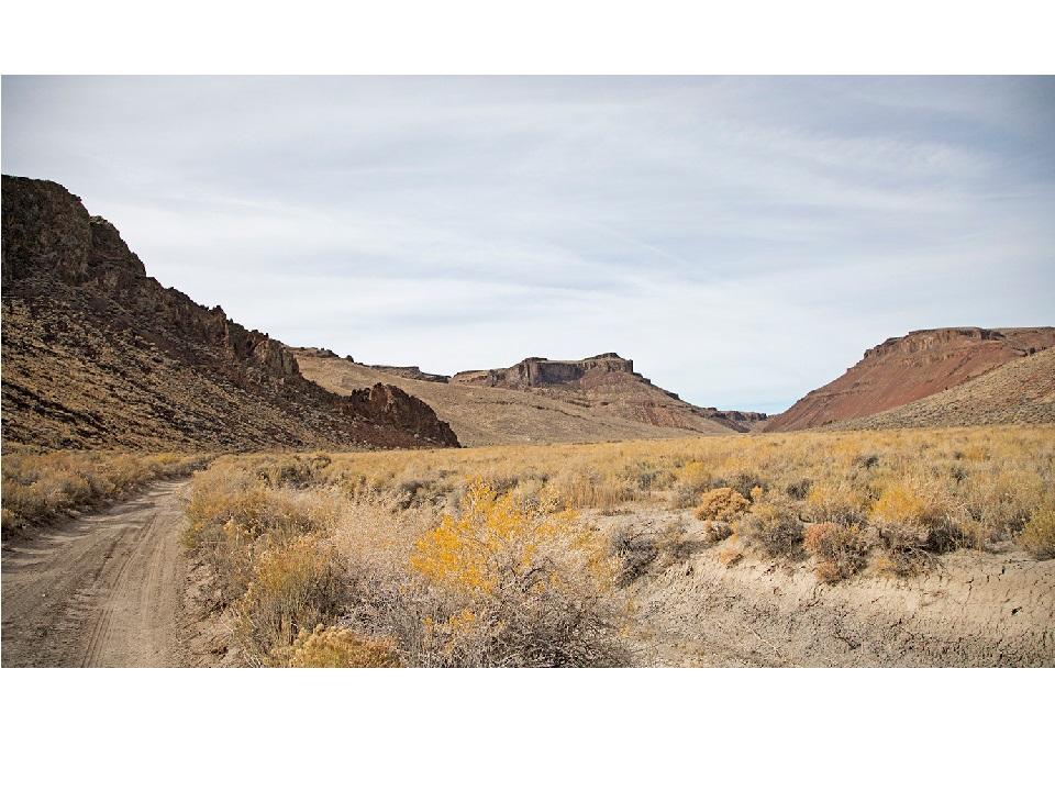
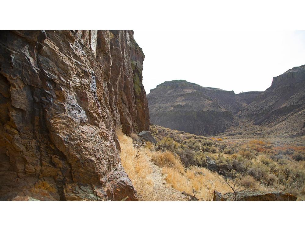
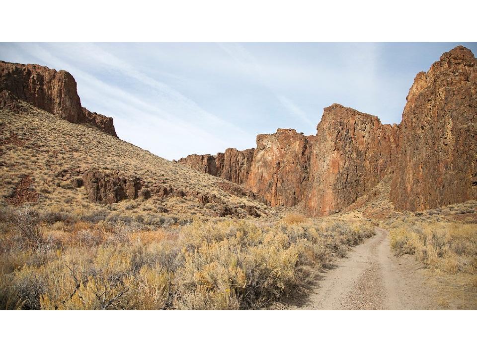
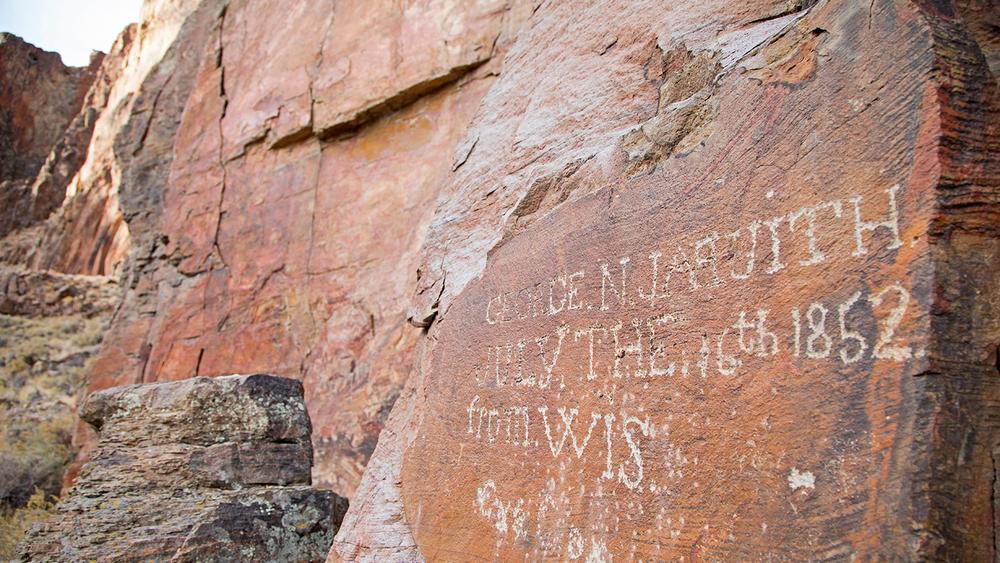
High Rock Canyon is an Area of Critical Environmental Concern (ACEC), spanning beyond 46,464 acres. Located in western Humboldt and northern Washoe Counties about 40 miles southeast of Cedarville, CA, this area has beautiful and scenic views, unique rock formations, dark skies, back roads, and plenty of wildlife, including bighorn sheep and raptor nesting sites. There are plenty of historic archaeology sites scattered throughout the canyons, as much of the vast wilderness areas have been left relatively untouched. High Rock Canyon is the product of both tectonic forces, as well as some ancient black lava flows that helped shaped these lands around 17 million years ago.
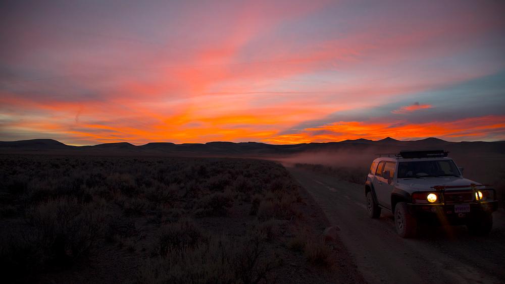
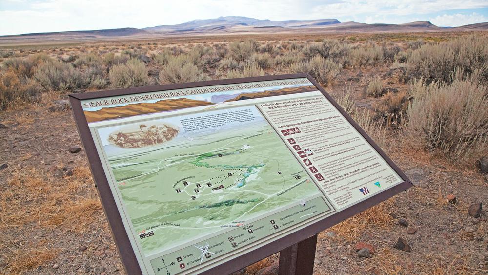
Recreation is encouraged throughout the High Rock region, and roadways are perfect for off-road vehicles with high clearance and 4-wheel drive. There are some fun areas to park and hike around, including the Upper High Rock Canyon Trail (41.48786, -119.49565). The Upper High Rock Canyon Trail is about one mile long and follows the National Historic Applegate Lassen Emigrant Trail along a small canyon stream. The trailhead can be found on the north end of the trail network, near Steven's Camp Recreation Area. Be sure to also check out Solider Meadows Cabin, about 60 miles north of the Black Rock entrance, along Soldier Meadow Road. The High Rock Canyon area is very remote and rugged area, and does not guarantee reliable cellular service. Use caution when recreating and planning for a visit!
Information from BLM – Black Rock Office:
High Rock Canyon east to High Rock Lake is very rugged and remote and can be driven in four-wheel vehicles by experienced and well equipped explorers. It is recommended that visitors bring extra spare tires, food, and, and water when traversing through the canyon. High Rock Canyon Road is closed each year between the end of chukar hunting season (around February 1st) until the second weekend in May to minimize human disturbance on nesting raptors and lambing bighorn sheep.
Camping is limited to designated sites only:
Nearby the High Rock Wilderness Area is the Black Rock Desert - home of Burning Man and Black Rock playa! Check out more information here!
Caution!! During wet seasons the playa, and some of the surrounding areas, can become impassable to motor vehicles. While the playa may appear dry, there may be deep mud just below the surface. It is important to note that OHV use is not allowed on the dunes and hummocks surrounding the playa.
Traveling in groups is always a good idea, as well as informing someone of where you will be going due to the remote nature of the conservation area. There is no natural source of safe drinking water, so be prepared to bring in enough water or a way to treat water. This area is very remote and cellphone coverage is not guaranteed. Plan ahead before recreating!
High Rock Canyon - Friends of Black Rock High Rock (blackrockdesert.org)
High Rock Canyon | Black Rock Desert | Gerlach, NV | Travel Nevada
High Rock Canyon | Bureau of Land Management (blm.gov)
The Dirt: Black Rock Desert | OFF-ROAD Nevada (nv.gov)
For more information, contact:
Download map files for your own use.
High Rock Canyon Wilderness is about 55 miles north of the town of Gerlach, NV. High Rock Canyon Road can be accessed from Washoe County 8A and Stevens Camp Road from the north, or from Washoe County Road 34 and High Rock Lake Road from the south.
Success! A new password has been emailed to you.