Ongoing construction and temporary closures around the Visitor Contact station. Please read the the Bureau of Land Management Public Notice for more detailed information or visit the Trails Alert tab. View the Trail Map tab for new reroutes and access points for the Petroglyph trail and 101 trail.
Pedestrian access to Petroglyph trail and 101 trail via Nahghaw Poa road is temporary and subject to change as construction continues. Keep an eye out for reroutes!
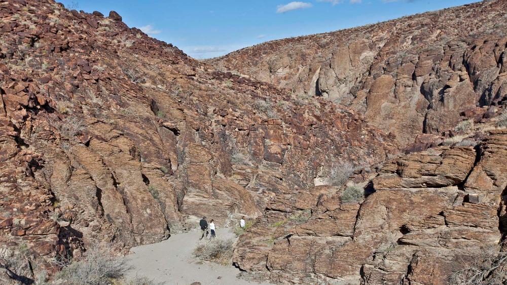
The Sloan Canyon National Recreation Area contains 48,438 acres of rugged beauty and includes the North McCullough Wilderness area. Most of the trails have a designated name but are also labeled with a trail number. Trails not located within the wilderness area are open to mountain bikers, equestrians and hikers. The flora of the area is dominated by creosote in the lower elevations and by Joshua Trees at higher elevations.
Popular trails include:
Watch this short PBS video on Sloan Canyon NCA to learn more about the ongoing trail efforts and local mountain bike community.
Please visit the BLM Sloan Canyon website for the most up to date closures.
The Anthem East Trail is one of the only ADA trails located at the edge of Sloan Canyon National Conservation Area. Visit the Trails Access Project website to learn more.
Dogs and horses are NOT allowed on the Petroglyph Canyon trail.
Backpacking and overnight camping and well as equestrian use is only allowed within the North McCullough Wilderness area. Click here to see the equestrian use and access map.
Summer temperatures typically exceed 100 degrees. Always pack extra water, wear long loose clothing and sunscreen.
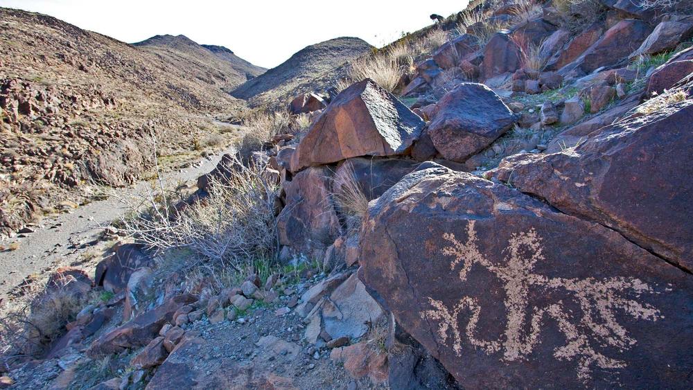
The Petroglyph Canyon trail is open sunrise to sunset. No pets are permitted on the trail unless they are service animals. Only hiking is allowed on this trail.
For the BLM map and trail descriptions click here!
For equestrian specific information visit Nevada Horse trails!
For additional information visit the BLM website or contact:


Download map files for your own use.
The main entry point and parking is located at the visitor contact center. During heavy use this parking lot may be closed for temporary parking only. The trail system can also be accessed via Anthem Hills park. A parking lot is located off of W Mission Dr that gives access to the north end of the Sloan Canyon trails. Several BLM roads also provide access to the the trails along the east and southern end.
Trailheads with paved road access:
Trailheads with dirt road access:
The petroglyph trail and 101 trail have recently been rerouted. Please follow the signs and markers along the new and improved trail. Reroute is to be in place until November 2026.
This trailhead has recently been relocated for the Petroglyph and 101 trail to the intersection of Division Drive and Nawghaw Poa road.
This trail passes by an important historical or cultural area. Please respect the area and future visitors by looking rather than touching.
The information center at this location is currently closed.
Success! A new password has been emailed to you.


