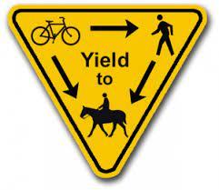
The Winnemucca area boasts a network of 26 diverse multiuse trails, among which the renowned Bloody Shins Trail takes the spotlight. Spanning 12 to 17 miles, its length depends on the chosen loops, offering distinct beginner, intermediate, and advanced segments.
For both hikers and horseback riders, an abundance of trails and rock gardens beckon exploration, rendering the possibilities seemingly boundless. Whether following established routes on the trail map or forging a personal adventure, the choices are yours to make.
These trails encompass a variety of terrains, featuring single tracks, double tracks, and dirt roads. Some align fully or partially with a connecting OHV trail system, adding to the versatility. It's worth noting that signage within the trail system can be sparse, adding an element of exploration to the experience.

Visit the City of Winnemucca website...
For additional information, visit the BLM - Winnemucca District website, or contact:
Bureau of Land Management - Winnemucca District OfficeThe main parking area and trailhead is located east of downtown Winnemucca on Kluncy Canyon Road. From I-80, take exit 178 for NV-289. Turn right onto NV-289 (East 2nd Street), then immediately take a left onto East Winnemucca Boulevard. Go 0.8 miles then take a right on North Highland Drive. After 0.4 miles, turn left onto Kluncy Canyon Road. Go 1 mile to the intersection with Rim Rock Road. The parking lot for the trailhead is a large dirt turn out, where Kluncy Canyon Road turns into a dirt road.
Success! A new password has been emailed to you.