The change of the season is upon us in Nevada. Visit 3  fall foliage locations between now and November 30th to get your leaf peeper badge!

Granite Range

 Hot springs, solitude and open roads. Who could ask for more?
Trail Uses
Utv/jeep driving Atv riding Dirt biking
Location
Washoe County
Length
677.00 miles (Network)
Town
Gerlach
Surface
Dirt
Pets
Permitted
Fees
No
Wilderness Areas
Black Rock Desert Wilderness Area, Calico Mountains Wilderness Area, High Rock Canyon Wilderness Area, Little High Rock Canyon Wilderness Area
Wilderness Study Areas
Buffalo Hills Wilderness Study Area, Fox Range Wilderness Study Area, Poodle Mountain Wilderness Study Area, Selenite Mountains Wilderness Study Area, Wall Canyon Wilderness Study Area
Other Activities
Hiking Mountain Biking E-biking Horseback Riding

Description

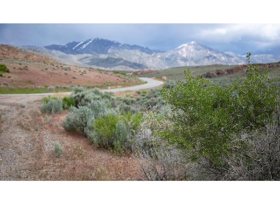
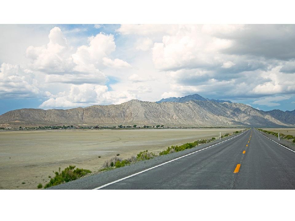
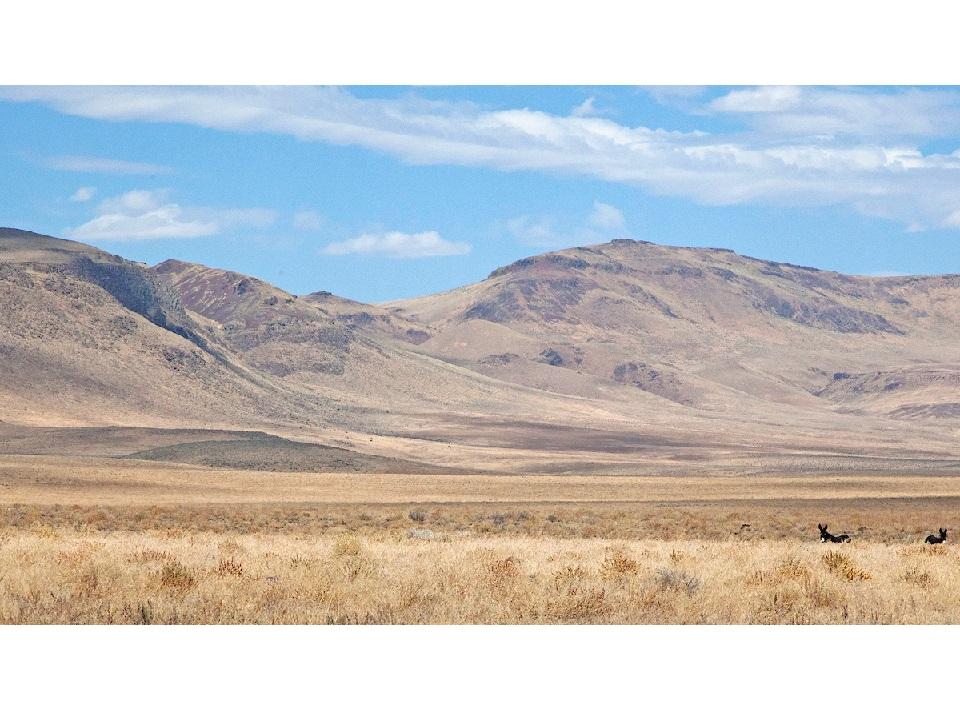
The Granite Mountain Range dominates the surrounding landscape northwest of Gerlach, Nevada and borders the Black Rock Desert. Due to the steepness of its eastern slope, ascents from the west are much more manageable. Starting in dry desert scrub, trails climb into juniper and sage-brush country where herds of deer and antelope can be found taking shelter from the heat found at lower elevations during the summer. Be wary, for some trails are much more difficult to traverse than others and a narrow width, high clearance vehicle may be necessary to reach the trails along its ridgeline. Other recreational opportunities include mountain climbing, hunting, and fishing at nearby Squaw Creek Reservoir.

Primitive camping can be found at Squaw Creek Reservoir free of charge, be sure to follow the rules as it is on private land and access can be revoked at the discretion of the owner.

Other Information

Visit Fish NV an Nevada Department of Wildlife website for more information on fishing and regulations!

Camping and fishing available at Wall Canyon Reservoir and Squaw Creek Reservoir. 

Check out the Fly geyser at Fly Ranch! Operated by the burning man project. 

Make sure to stop by and check out the George Lund Petrified forest

Nearby lodging and services are located in Gerlach. 

Motor vehicles are permitted on designated trails only. For local regulations regarding OHV use on county roads, visit the BLM OHV Website https://www.blm.gov/programs/recreation/OHV. Always plan ahead and prepare for uncertainty. Travel with warm clothing, first aid, food, water and appropriate tools to fix a problem.

Portions of the Granite Range are near designated wilderness, only hikers and equestrians are allowed within the wilderness boundary. Motorized and mechanized use is only permitted on surrounding non-wilderness trails. Please be respectful of the wilderness boundary and only travel on designated roads and trails for your activity type. Horses are allowed and only certified weed free hay can be brought in.

Trail Manager

For more information visit the BLM website or contact: 

Bureau of Land Management - Black Rock Field Office

Bureau of Land Management - Black Rock Field Office
5100 East Winnemucca Blvd.
Winnemucca, NV 89445
Winnemucca, Nevada 89445
Phone: 775-623-1500
wfoweb@blm.gov
View website

Bureau of Land Management - Surprise Field Station

Bureau of Land Management - Surprise Field Station
602 Cressler Street
Cedarville, California 96104
Phone: (530) 279-6101
View website

Download

Download map files for your own use.

Working with Downloaded Files

Recreate Responsibly

Plan Ahead and Prepare
Tell someone your plan and when you’ll return, just in case.
Legend
|
Hide All

Trailhead Information

From Reno to Squaw Creek Reservoir staging area/campground:

  • Take I-80 East for 30 miles, then take Exit 43 toward Wadsworth/Pyramid Lake.
  • Turn left onto I-80BUS East and continue for 5 miles. Turn left onto NV-447 N / Washeim St.
  • Follow NV-447 North for 75 miles.
  • Continue onto County Rd 447/Main St. for 17 miles. Destination is on the left.
Click on a parking icon to get custom directions
Please Log In or Create Account to add comments.
SHARE THIS TRAIL
PRINT THIS TRAIL

Add Trail Log

Please wait…
Facebook Instagram Twitter YouTube
Join In on the Fun!
Log in or create an account below to unlock all the great features of Nevada Trail Finder: keep track of trails you want to do, preserve memories of trails you’ve done, earn badges, and more!
Your log in attempt was not successful. Please try again.
    Lost your password? Reset your password
    Don't yet have an account?
    There was an issue with your submission. Please try again.
      * Indicates required field
      Already have an account? Login here
      Enter your username, and we will send you a new, randomly generated password to your email account.
      There was an issue with your submission. Please try again.

        Success! A new password has been emailed to you.

        Log in now

        Please wait…